Drone Survey & Aerial Inspection: Revolutionizing Industries from Above

In the fast-paced world of technology, the utilization of drones has brought about a remarkable transformation in various industries. Drone survey and aerial inspection have become invaluable tools that offer a bird's-eye view of our world. From agriculture and construction to environmental monitoring and beyond, drones have changed the way we gather data, make decisions, and conduct inspections. In this comprehensive article, we will delve into the fascinating world of drone survey and aerial inspection, exploring their applications, benefits, challenges, and the promising future they hold.


The Rise of Drone Technology


Drones, also known as Unmanned Aerial Vehicles (UAVs), have evolved from their military origins to become versatile assets in civilian sectors. These flying machines are equipped with cameras, sensors, and advanced navigation systems, making them indispensable for a wide range of applications.


1. Agriculture: Precision Farming


One of the most significant impacts of drone technology is felt in agriculture. Precision farming, enabled by drone survey, has revolutionized the way crops are grown. Drones equipped with multispectral cameras can capture high-resolution images of farmland, providing farmers with essential data on crop health, pest infestations, and irrigation needs. This information allows for targeted interventions, reducing resource wastage and increasing yields.


2. Construction: Site Monitoring


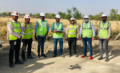
In the construction industry, monitoring the progress of large projects can be a daunting task. Drones offer a cost-effective solution by providing real-time aerial views of construction sites. Project managers can use this data to track progress, ensure adherence to plans, and enhance safety measures. The ability to spot potential issues from above saves both time and money.


3. Environmental Conservation: Wildlife Monitoring


Conserving our planet's biodiversity is a top priority. Drones play a vital role in this endeavor by allowing researchers to monitor wildlife without disturbing their habitats. From counting endangered species to tracking migration patterns, drones offer insights that are essential for conservation efforts.


4. Infrastructure Inspection: Keeping Cities Safe


Maintaining infrastructure like bridges, power lines, and pipelines is crucial for public safety. Aerial inspection using drones has made this task more efficient and cost-effective. Drones can access hard-to-reach areas, capture high-resolution images, and detect structural issues before they become critical.


Advantages of Drone Survey & Aerial Inspection


The adoption of drone survey and aerial inspection brings forth several compelling advantages:


1. Safety First


In industries like construction and infrastructure inspection, sending humans into hazardous environments can be risky. Drones eliminate this danger by taking on the task. They can explore unstable structures, assess damage after natural disasters, and minimize the risk to human lives.


2. Cost-Efficiency


Traditional methods of aerial data collection, such as manned aircraft, are expensive. Drones are more cost-efficient, requiring minimal manpower and fuel. This affordability makes high-frequency surveys and inspections feasible, leading to better decision-making.


3. Rapid Data Acquisition


Drones can cover vast areas in a short time, collecting extensive data in a matter of hours. This rapid data acquisition accelerates project timelines and enables quicker responses to emerging issues.


4. Enhanced Accuracy


With advanced GPS and camera technology, drones can provide highly accurate data. This precision is especially critical in agriculture, where minor variations in crop health data can translate to substantial yield improvements.


Challenges and Considerations


While drone survey and aerial inspection offer significant advantages, they are not without challenges:


1. Regulatory Hurdles


The use of drones is subject to strict regulations, especially in urban areas and near airports. Compliance with these regulations is essential to avoid legal complications.


2. Data Security


Collecting and transmitting data via drones can raise concerns about data security and privacy. Ensuring secure data storage and transmission is crucial.


3. Weather Limitations


Adverse weather conditions can limit the operational window for drones. Rain, strong winds, and low visibility can disrupt survey and inspection schedules.


The Future of Drone Technology


As technology continues to advance, the future of drone survey and aerial inspection looks promising. Here are some exciting developments on the horizon:


1. Automation and AI Integration


Drones are becoming smarter with the integration of artificial intelligence. They can autonomously analyze data, detect anomalies, and make real-time decisions, further enhancing their capabilities.


2. Increased Payload Capacity


Future drones are expected to carry more significant payloads, enabling the use of more advanced sensors and equipment. This will expand their applicability in various industries.


3. Beyond Visual Line of Sight (BVLOS) Operations


Regulatory changes are paving the way for BVLOS operations, allowing drones to travel longer distances. This opens up new possibilities for industries like logistics and delivery services.


Conclusion


In conclusion, drone survey and aerial inspection have emerged as game-changers across multiple industries. Their ability to provide safety, cost-efficiency, rapid data acquisition, and enhanced accuracy is reshaping how businesses operate and make decisions. While challenges like regulations and data security persist, ongoing advancements in technology promise a brighter future for drones. As industries continue to harness the power of drones from above, their potential to revolutionize even more sectors remains limitless. Embracing this technology is not just an option; it's a necessity for staying competitive and efficient in today's fast-paced world.


Visit More :- 


https://penzu.com/p/b0644202ab791e5c

https://www.tumblr.com/garud-survey/728776485738004480/a-birds-eye-view-drone-surveys-transforming?source=share

https://www.evernote.com/shard/s383/sh/9399f3bb-9834-4569-a1d9-7fb402b30423/r2mOos6S3ILuSEw8WtaBjcWtEfqJVaJvjnE0t6vvCUV9Wq6PM_PJwCFLLQ

https://sites.google.com/view/lidar-survey/home

https://justpaste.it/734hj

https://medium.com/@garudsurvey50/a-birds-eye-view-drone-surveys-transforming-jaipur-e69fd5f9caf0

https://garudsurveyprivatelimited.blogspot.com/2023/09/blog-post_17.html

https://qr.ae/pKXNl9

https://telegra.ph/A-Birds-Eye-View-Drone-Surveys-Transforming-Jaipur-09-18

https://garudsurvey.wordpress.com/2023/09/18/a-birds-eye-view-drone-surveys-transforming-jaipur/

https://www.bloglovin.com/@garudsurvey/a-birds-eye-view-drone-surveys-transforming

https://considerate-deer-fvfmnt.mystrikingly.com/

https://www.pr3-articles.com/Articles-of-2020/birds-eye-view-drone-surveys-transforming-jaipur

https://www.pr4-articles.com/Articles-of-2020/birds-eye-view-drone-surveys-transforming-jaipur

https://www.pearltrees.com/rishbhsharma/item542162056

https://www.pr5-articles.com/Articles-of-2020/birds-eye-view-drone-surveys-transforming-jaipur

https://anotepad.com/notes/74np7eyd

https://qr.ae/pK7p3y

https://qr.ae/pK7IIZ

https://qr.ae/pK7IGN

https://qr.ae/pK7Inr

https://qr.ae/pK7Ir3

https://qr.ae/pK7Iyr

https://qr.ae/pK7IyE

https://qr.ae/pK7I2n

https://bookmark.wtguru.com/submit/?storyurl=https%3A%2F%2Fgarudsurvey.com%2Fdrone-survey-company-in-udaipur%2F&storytitle=Professional+Drone+Survey+Services+in+Udaipur+%7C+Aerial+Insights&storydesc=Unlock+the+full+potential+of+your+Udaipur+projects+with+our+expert+drone+survey+services.+Our+seasoned+team+specializes+in+providing+high-quality+aerial+data+collection%2C+precise+mapping%2C+and+invaluable+insights.+Whether+you%27re+in+construction%2C+agriculture%2C+real+estate%2C+or+environmental+management%2C+our+cutting-edge+technology+and+experienced+operators+will+help+you+make+informed+decisions+and+streamline+your+operations.+Contact+us+today+to+discover+how+our+Drone+Survey+in+Udaipur+endeavors%2C+improve+efficiency%2C+and+ensure+project+success.&storytags=Drone+Survey+in+Udaipur

https://mootin.com/story/business/delhi-drone-survey-services-aerial-mapping-insights

https://linkz.us/listing-professional-drone-survey-74892.html

https://archive.org/details/drone-survey-in-gwalior

https://bluebook-directory.blackandbluedirectory.com/index.php?p=d

https://club-ctejidas.mn.co/posts/42602423?utm_source=manual

https://connectgalaxy.com/post/92820_rishikesh-drone-surveys-aerial-mapping-amp-inspection-services-unlock-the-potent.html

https://dbook.mn.co/posts/42602722

https://digg.wtguru.com/submit/?storyurl=https%3A%2F%2Fgarudsurvey.com%2Fdrone-survey-in-gujarat%2F&storytitle=Drone+Surveys+in+Gujarat+%7C+Aerial+Mapping+%26+Inspection+Services&storydesc=Experience+top-tier+drone+survey+in+Gujarat.+Our+services+include+precise+aerial+mapping%2C+inspections%2C+and+data+analysis+for+diverse+industries.+Harness+the+power+of+drone+technology+for+cost-effective+and+efficient+surveys+in+Gujarat%2C+India%2C+ensuring+better+project+outcomes+and+data-driven+decisions.&storytags=Drone+Survey+in+Gujarat

https://mimedia.in/post/7774_haridwar-drone-survey-services-for-precision-mapping-and-analysis-elevate-your-p.html

https://fbbookmark.com/page/business-services/bihar-drone-survey-services-precision-aerial-mapping-analysis

https://flip.it/Uuwn6X

https://fnetchat.com/post/553460_gurugram-drone-survey-services-precision-aerial-mapping-amp-analysis-elevate-you.html

https://gab.com/rishbhsharma012/posts/111101559736676570

https://gettr.com/post/p2qyxpl75a7

https://halliving.com/post/4014_professional-drone-survey-services-in-uttarakhand-aerial-mapping-experts-elevate.html

https://homment.com/ODD4nMPAQt7gmDjt4fxN

https://inc-research.mn.co/spaces/9350498/members/new

https://jibonbook.com/post/136607_professional-drone-survey-services-in-ahmedabad-aerial-mapping-experts-elevate-y.html

https://justpaste.me/jCmN1

https://cloud.gonitro.com/doc/2502749408/v/2502749409

https://www.mediafire.com/file/o7u1k2vjwnmu02x/Elevate_Mining_Operations_with_Cutting-Edge_Mining_Drone_Technology.pdf/file

https://jmp.sh/iVuC4Gnc

https://www.edocr.com/v/xbnylopx/garudsurvey/revolutionize-land-surveying-with-drones-precision

https://www.slideshare.net/RishbhSharma4/optimize-land-surveying-with-drones-accurate-data-faster-resultspdf

https://www.dropbox.com/scl/fi/km3xtoyqkcie68n407m8t/Elevate-Land-Surveying-Efficiency-with-Advanced-Land-Survey-Drones.pdf?rlkey=v03rg5z71izaxw7ehmg37pfk5&dl=0

https://www.4shared.com/s/fO9AOBpqUjq

https://view.axel.org/item/083b1858328dfc05

http://tbf.me/a/CODv9C

https://pdf.ac/yowOf

https://mega.nz/file/BWFECIbQ#BwEMgV7Vky61okFwHLSp42BJtKQDXvfasce0jo71jts

https://pdfhost.io/v/SmCW9.Gsm_Transforming_Construction_Drones_Impact_on_Efficiency_and_Safety

https://files.fm/f/d2u94k5w6

https://www.pearltrees.com/rishbhsharma/item544512022

https://www.slideserve.com/Rishbh/optimize-crop-inspection-enhance-yield-and-quality-with-precision

https://garudsurvey.dropmark.com/1555946/33012846

https://spaces.hightail.com/receive/fJUaFmEnZp

https://www.docslides.com/garudsurvey/elevate-accuracy-and-efficiency-with-lidar-surveys-precision-mapping-and-data-insights

https://workdrive.zoho.in/file/dke35ae01fe9dd73147ada7a814dd594fbd8d

https://u.pcloud.link/publink/show?code=XZjGGGVZp3EgK5y5HFH6BggHvUxXnuqdBrik

https://visual.ly/community/Others/business/elevate-land-surveying-efficiency-advanced-land-survey-drones

https://smallpdf.com/file#s=7bc68eed-fc4b-43ad-b9d1-b46ac28252b5

https://dochub.com/m/shared-document/rishbh-sharma/JWop0ZAKkdp9Qp7VrYa9GP/enhance-precision-with-drone-topographic-surveys-accurate-terrain-data-pdf?dt=ewqK-QxKH-hPsAA6KTxZ

https://pinpdf.com/understanding-aerial-survey-costs-budgeting-for-precision-in-786b0c277cbc413fe7357e1f6402d250.html

http://depositfiles.com/files/3e1v086gn

https://pubhtml5.com/cygh/osme/

https://www.omaada.com/posts/88157

https://www.owink.com/post/82871_elevate-mining-operations-with-cutting-edge-mining-drone-technology-discover-the.html

https://pin.it/5vJwzCJ

https://www.producthunt.com/discussions/revolutionize-land-surveying-with-drones-precision-efficiency-and-cost-savings

https://sco.lt/8TC4tU

https://www.socialbookmarkiseasy.info/preview-story/

https://www.socialbookmarkzone.info/preview-website/

https://www.storeboard.com/blogs/business/enhance-precision-with-drone-topographic-surveys-accurate-terrain-data/5663396

https://www.sutori.com/en/story/untitled--DHT2iEcsCnLkAXNr1fTQ2ALa

https://www.wattpad.com/1384640763-enhance-safety-and-efficiency-with-drone-building

https://yusocial.com/post/16690_transforming-construction-drones-039-impact-on-efficiency-and-safety-explore-how.html

https://stumble.wtguru.com/2023/09/23/elevate-solar-panel-efficiency-with-drone-inspection-services/

https://www.omaada.com/garudsurvey

https://www.owink.com/garudsurvey

https://www.producthunt.com/@garudsurvey

https://www.provenexpert.com/garudsurvey/

https://www.sutori.com/en/garud-survey-private-limited?tab=profile

https://www.tripoto.com/profile/rishbhsharma


Comments

Popular posts from this blog

How India's Drone Survey Company is Reshaping Industries