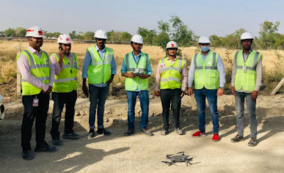
Drone Survey in Jaipur: Unlocking the Power of Aerial Insights

Welcome to our comprehensive guide on drone survey in Jaipur, where we delve into the transformative potential of aerial surveys and how they can benefit various industries. From construction and real estate to agriculture and urban planning, drone surveys have revolutionized data collection and analysis, offering unprecedented accuracy, efficiency, and cost-effectiveness.
The Rise of Drone Surveys
Over the past decade, the utilization of drones for surveying purposes has witnessed a remarkable rise, and Jaipur, the vibrant Pink City of India, is no exception. Drone surveys have become increasingly popular due to their ability to capture high-resolution imagery, create detailed 3D models, and collect precise geospatial data from previously inaccessible locations. This technology has opened up a world of possibilities for professionals across numerous sectors.
Unparalleled Accuracy and Efficiency
One of the primary advantages of drone surveys is their ability to provide unparalleled accuracy and efficiency in data collection. Traditional surveying methods often involve manual measurements that are time-consuming, labor-intensive, and prone to human error. With drones, however, the entire process becomes streamlined and automated, significantly reducing both time and costs associated with data acquisition.
Real Estate and Construction Applications
In the real estate and construction industries, drone surveys have emerged as indispensable tools for site analysis, project planning, and monitoring progress. By capturing high-resolution aerial imagery and generating 3D models, drones enable professionals to visualize the terrain, identify potential challenges, and make informed decisions. This level of detail and accuracy leads to more efficient construction processes and improved project outcomes.
Agricultural Insights from Above
Drones have also revolutionized the agricultural sector by providing valuable insights from above. With multispectral sensors and thermal cameras, drones can assess crop health, monitor irrigation systems, and detect signs of pests or diseases. This data empowers farmers to optimize their cultivation practices, reduce resource wastage, and maximize crop yields. In Jaipur, where agriculture plays a significant role in the economy, drone surveys have the potential to transform farming practices and increase overall productivity.
Urban Planning and Infrastructure Development
Garud Survey Private Limited agencies in Jaipur are leveraging drone surveys to support informed decision-making for infrastructure development projects. By capturing detailed aerial imagery and mapping out the existing urban landscape, drones assist in assessing land suitability, planning transportation networks, and identifying areas for development or conservation. This data-driven approach enables more efficient Garud Survey, fostering sustainable growth while preserving the city's heritage.
Environmental Conservation and Wildlife Monitoring
Drones play a crucial role in environmental conservation efforts and wildlife monitoring. In Jaipur, known for its rich biodiversity and proximity to national parks, drone surveys offer a non-intrusive means of observing and protecting ecosystems. From monitoring wildlife populations and habitat conditions to identifying illegal activities such as poaching or deforestation, drones provide vital information for conservationists and authorities, contributing to the preservation of Jaipur's natural heritage.
Overcoming Challenges and Ensuring Compliance
While drone surveys offer immense potential, it is essential to address challenges and ensure compliance with regulations. In Jaipur, as in any other location, it is crucial to adhere to local laws and obtain necessary permits for drone operations. Additionally, factors such as weather conditions, airspace restrictions, and privacy concerns must be carefully considered to ensure safe and responsible drone survey practices.
Conclusion
Drone surveying has emerged as a game-changing technology, revolutionizing industries and unlocking new possibilities for professionals in Jaipur. The unparalleled accuracy, efficiency, and cost-effectiveness of drone surveys have made them indispensable tools in fields ranging from construction and agriculture to urban planning and environmental conservation. By harnessing the power of aerial insights, individuals and organizations can make informed decisions, drive innovation, and contribute to the sustainable development of Jaipur.And drone survey survice available at diffrent Location and pan india.

Comments
Post a Comment