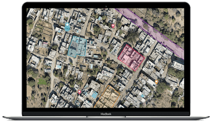
How Drone Surveys and Aerial Inspections Are Reshaping Industries
In today's rapidly evolving world, technological advancements have paved the way for groundbreaking innovations that are reshaping industries across the globe. One such innovation that is revolutionizing various sectors is the utilization of drone surveys and aerial inspections. These cutting-edge technologies are providing businesses with unprecedented opportunities to gather valuable data, enhance operational efficiency, and make informed decisions. In this article, we will explore the transformative impact of drone survey & aerial inspection on different industries and how they are propelling businesses to new heights.
1. Improving Efficiency and Accuracy in Construction
The construction industry has embraced drone surveys and aerial inspections with open arms, recognizing their immense potential to streamline processes and improve overall efficiency. Drones equipped with high-resolution cameras and advanced imaging technologies can capture detailed aerial imagery of construction sites, enabling project managers and engineers to monitor progress, identify potential issues, and make timely adjustments.
By conducting regular aerial inspections, construction companies can identify safety hazards, ensure compliance with regulations, and maintain a secure working environment. The real-time data obtained from drone survey in Pune empowers decision-makers to address challenges promptly, optimize resource allocation, and mitigate risks. This enhanced level of precision and accuracy not only saves time and money but also ensures that projects are completed within stipulated timelines.
2. Enhancing Agricultural Practices
The agricultural sector is another industry that has harnessed the power of drone surveys and aerial inspections to drive innovation and improve productivity. Traditional methods of monitoring crops and assessing field conditions often involve time-consuming manual labor and subjective assessments. However, drones equipped with specialized sensors and thermal imaging capabilities can provide farmers with a comprehensive view of their crops' health and detect potential issues such as pests, diseases, or irrigation problems.
By analyzing the data collected through aerial inspections, farmers can make data-driven decisions regarding crop management, resource allocation, and the application of fertilizers or pesticides. This precision agriculture approach optimizes yield, reduces environmental impact, and ensures sustainable farming practices. Drone survey in Rajasthan also enable farmers to monitor large areas of land efficiently, making it a cost-effective solution for both small-scale and large-scale agricultural operations.
3. Revolutionizing Infrastructure Maintenance
Maintenance and inspection of critical infrastructure, such as bridges, power lines, and pipelines, are crucial for ensuring public safety and minimizing disruptions. Drone survey in Uttarakhand are playing a pivotal role in revolutionizing these maintenance practices by offering a safer, more efficient, and cost-effective alternative to traditional inspection methods.
By using drones to conduct inspections, infrastructure managers can avoid the need for expensive equipment, risky manual inspections, and disruptive road closures. Drones equipped with high-definition cameras and advanced imaging technologies can capture detailed visual data, allowing engineers to assess the condition of infrastructure assets remotely. This remote monitoring capability facilitates proactive maintenance planning, early detection of defects, and the implementation of preventive measures, ultimately reducing downtime and extending the lifespan of critical infrastructure.
4. Accelerating Environmental Conservation Efforts
Preserving and safeguarding the environment is a global concern, and drone surveys and aerial inspections are proving to be invaluable tools in accelerating environmental conservation efforts. These technologies enable researchers, environmentalists, and conservationists to monitor wildlife populations, map ecosystems, and assess the impact of human activities on sensitive habitats.
Drones equipped with specialized sensors and thermal imaging capabilities can gather critical data on wildlife behavior, species distribution, and habitat health. This data, combined with advanced analytical techniques, provides valuable insights for designing targeted conservation strategies and implementing effective environmental management plans. The ability to cover vast areas efficiently and collect high-resolution imagery has made drone survey in Hyderabad a game-changer in environmental monitoring, ensuring the preservation of delicate ecosystems for future generations.
5. Transforming the Insurance Industry
The insurance industry, traditionally known for its meticulous claim assessment and risk
analysis processes, is also being transformed by the integration of drone surveys and aerial inspections. Insurance companies can leverage the power of drones to gather accurate and real-time data during the claims process, enhancing efficiency, reducing disputes, and expediting settlements.
After a natural disaster or an accident, drones can be deployed to assess property damage quickly and accurately. High-definition imagery and video footage obtained from aerial inspections enable insurance adjusters to evaluate claims remotely, eliminating the need for extensive on-site visits. This streamlined process not only reduces costs but also enhances customer satisfaction by providing faster claim settlements and improved transparency.
In conclusion, drone surveys and aerial inspections are ushering in a new era of innovation across various industries. From construction and agriculture to infrastructure maintenance, environmental conservation, and insurance, these technologies are driving efficiency, accuracy, and cost savings. By leveraging the power of drones, businesses can gather precise data, make informed decisions, and stay ahead of the competition in an increasingly competitive landscape.
Business Name- Garud Survey Private Limited
Business Address- 108 MIIC, Near MNIT Campus, JLN Marg, Jaipur, Raj.
Business Number- 7733911999 / 7230911999
Drone Survey & Aerial Inspection


Comments
Post a Comment