Revolutionizing Land Surveying with Drones: A Look into the Future
Introduction:
Technology has continuously played a crucial role in boosting precision, efficiency, and accuracy in the constantly changing field of land surveying. The deployment of drones, one of the most innovative developments in recent years, has changed how land surveyors approach their profession. We'll go into the realm of land survey drones in this blog article and examine how these amazing tools are changing the land surveying industry.
The Rise of Land Survey Drones:
Traditional land surveying methods usually required time- and money-consuming, labor-intensive stages. Surveyors would go through challenging terrain, measure distances by hand, and use a variety of tools to acquire information. The laws of the game have, however, fundamentally changed as a result of the development of drone technology.
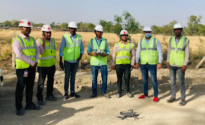
Unmanned aerial vehicles (UAVs), commonly known as drones, are being used more frequently by land surveyors today to carry out surveys swiftly, effectively, and with a level of precision that was previously unthinkable. Here are some notable ways that land survey drones are changing the landscape:
1. **Rapid Data Collection:** Drones equipped with high-resolution cameras and LiDAR (Light Detection and Ranging) sensors can capture vast amounts of data in a short amount of time. This allows surveyors to obtain comprehensive and accurate data on the terrain, including elevation, contours, and even vegetation.
2. **Enhanced Safety:** Drones eliminate the need for surveyors to traverse hazardous or remote areas, reducing the risks associated with fieldwork. This has a positive impact on both worker safety and project timelines.
3. **Cost-Efficiency:** By streamlining the surveying process, drones can significantly reduce costs associated with labor, equipment, and resources. Projects that once required extensive manpower can now be completed with a single drone operator.
4. **Improved Accuracy:** Drones are equipped with GPS technology that ensures precise georeferencing of collected data. This level of accuracy is vital for various applications, including construction, infrastructure development, and environmental monitoring.
5. **Real-Time Insights:** The data collected by land survey drones can be processed in real-time, allowing surveyors and project managers to make informed decisions promptly. This leads to increased project efficiency and better outcomes.
Applications of Land Survey Drones:
The versatility of land survey drones extends far beyond traditional land surveying. Here are some notable applications:
1. **Construction:** Drones can monitor construction progress, track earthwork, and create 3D models for design and analysis.
2. **Agriculture:** Precision agriculture benefits from drones by assessing crop health, irrigation needs, and soil conditions.
3. **Environmental Conservation:** Drones aid in monitoring and preserving natural habitats, wildlife populations, and detecting environmental changes.
4. **Infrastructure Inspection:** Drones can inspect bridges, power lines, and pipelines, helping identify maintenance needs and potential issues.
5. **Emergency Response:** Drones assist in disaster management by providing aerial views for search and rescue operations and damage assessments.
Conclusion:
The use of land survey drones in the field of land surveying is constantly evolving as a result of technological advancements. Drones are revolutionizing how projects are planned, carried out, and monitored thanks to their capacity to offer quick, accurate, and cost-effective data. Airborne surveying is clearly the way of the future for land surveying, and as technology advances, we may anticipate many more fascinating possibilities that will improve the state of land surveying.

Comments
Post a Comment